
In April 2015 I hiked the 50 mile “W Circuit” in Torres del Paine National Park, Chile with one of my best freinds, Karl. It’s a 5 day trek through a striking section of the Andes Mountains near the tip of South America. We’d just completed a week of hiking the backcountry around Mt. Fitz Roy in El Chalten, Argentina. It was photography paradise with easy hiking, good weather, and lots of keepers. Things wouldn’t remain so ideal. From El Chalten we connected a series of buses that took us a few hours south to Puerto Natales in Chili, and from there into Torres del Paine NP. Truth be told, the real adventure began months before the trip trying to figure out local transportation. Once we arrived in Torres del Paine, the first 3 days of hiking took us along Lago Grey, filled with icebergs emanating from the monstrous South Patagonia Ice Field, and up the magnificent French Valley. It was beautiful, but uneventful, and dull light kept me from capturing any keeper photos, just snapshots to document the trip. True adventure happens amidst calamity and challenge. That’s how I prefer my trips because it produces unforgettable lucid memories. It was on our 4th day that things got interesting.
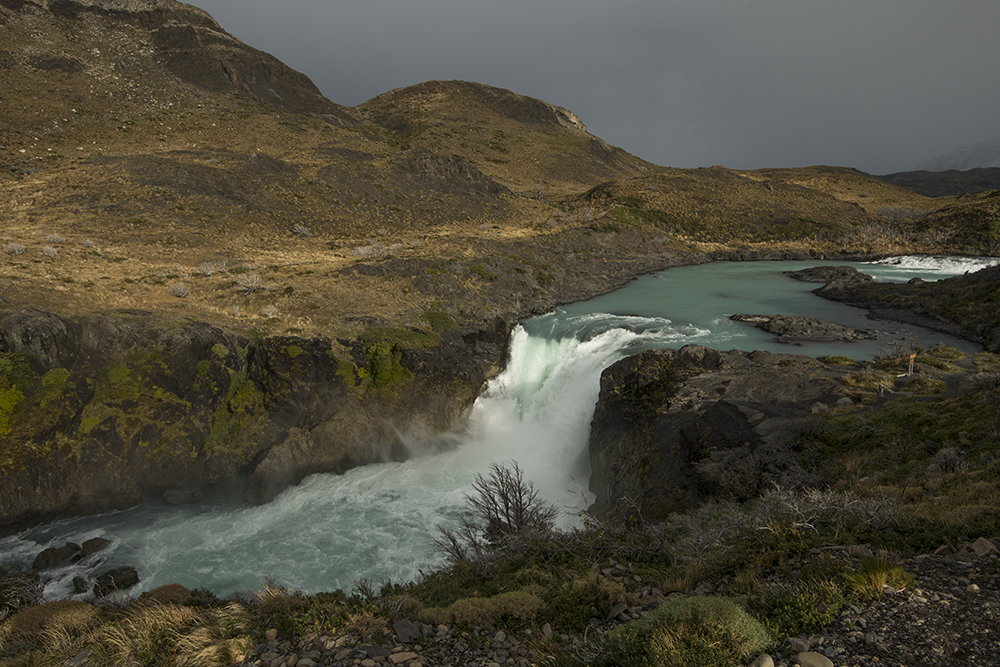
You can view the Salto Grande Waterfall after being dropped off in the park by bus, before you board the ferry.
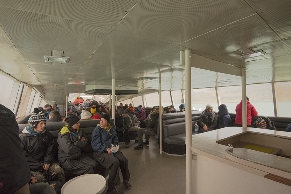
The ferry delivers backpackers across Lago Peho to the start of the W circuit
Day 4 brought an epic 14 mile hike between camps. It was from Refugio Cuernos to Camp Torres near the top of the vast Acencio Valley. At Camp Torres we’d spend the night, and hike up to Mirador Torres the next morning to catch sunrise. Mirador Torres was the trophy shot for which most photographer make this journey, and the shot that I hoped would salvage this trip.
The W Circuit basically consists of hiking up the valley to the left of the pictured mountain massif, then along its face, then up the valley on the other side.
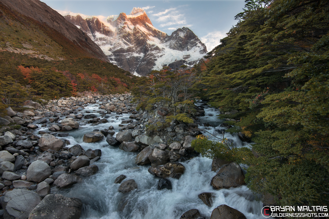
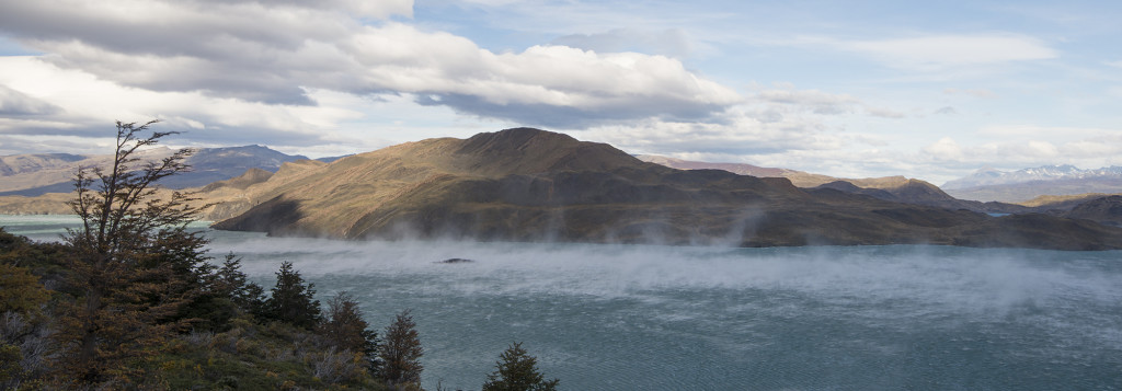
The first 7 miles of our 14 mile hike went along giant Lake Nordenskjold. The trail ran between the lake and up against the steep face of the mountains. On the map it looked like an easy stroll along the lake, but the trail climbed continuously up and down the mountain spurs protruding into the lake.
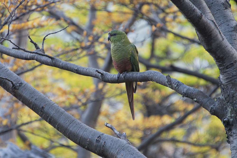
Austral Parakeet
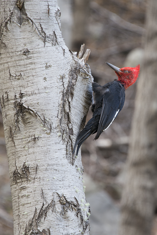
Magellanic Woodpecker
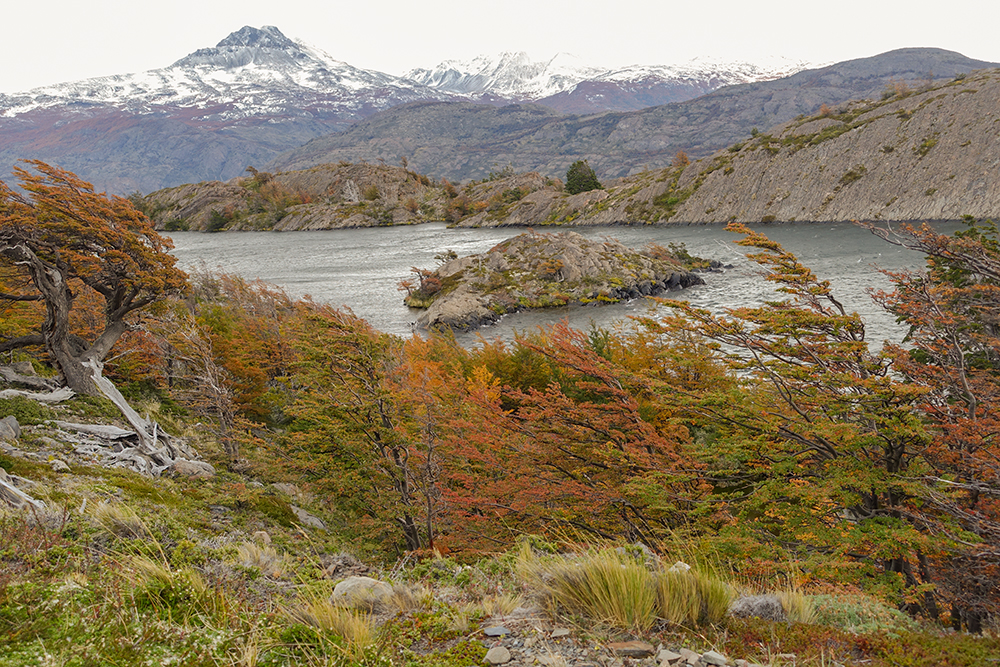
Despite being so close to the Arctic Circle, the nearby Pacific Ocean creates an unstable, but mild maritime climate. Rhododendrons and blooming Foxglove proliferated along the lake shores. While the mountains were lush, the foothills immediately to the east were tan and dry as if a line had been drawn where the rain shadow begins. Lenga Beech dominated the mountains. They’re shaped by the constant wind with branches reaching in the direction of the wind. They resembled Bonsai Trees. Now at the height of Fall colors in mid April, the Lenga’s tiny leaves were burning shades of orange and crimson. Almost every inch of the ground was covered with the edible Calafate Berry Bush (Box-leaved Barberry). They were at peak ripeness, and so laden with berries that you could harvest endless handfuls. I ate so many while hiking that they contributed a significant to my caloric intake.
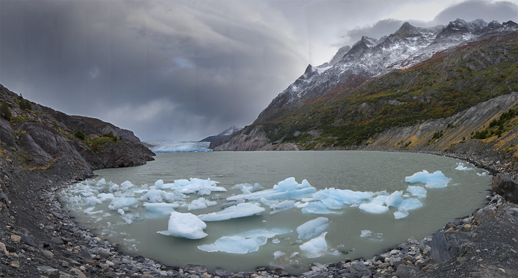
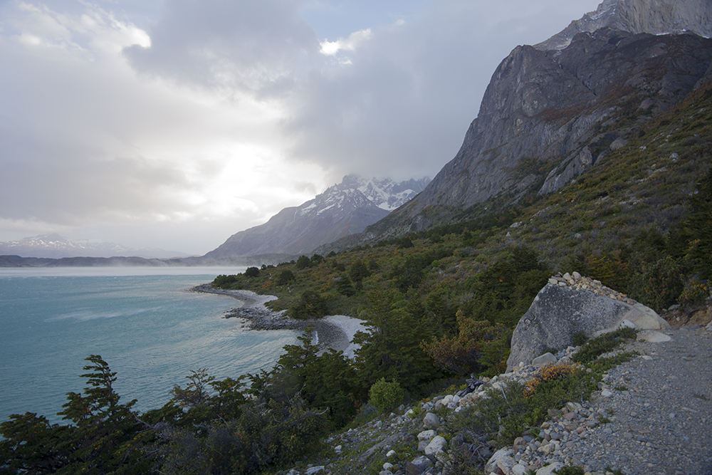
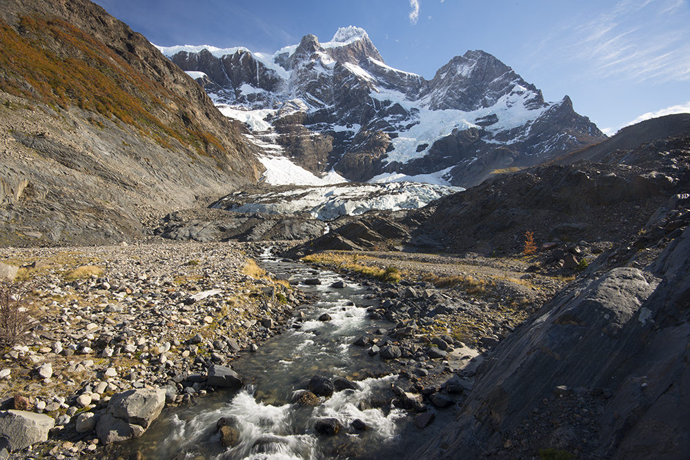
Icebergs from Glacier Grey on day one
Animal life wasn’t abundant, but what I did encounter was interesting. I came across what I thought were Parrots in the forest, but were the Austral Parakeet. I also saw the large Magellanic Woodpecker with radiant auburn head. Guanaco (a type of Lama) and Rhea (an Ostrich-like bird) roamed the edge of the park in the arid foothills where the Pampas began. I was also lucky enough to see the Andean Condor who silently glides with its incredible wingspan like a giant apparition.
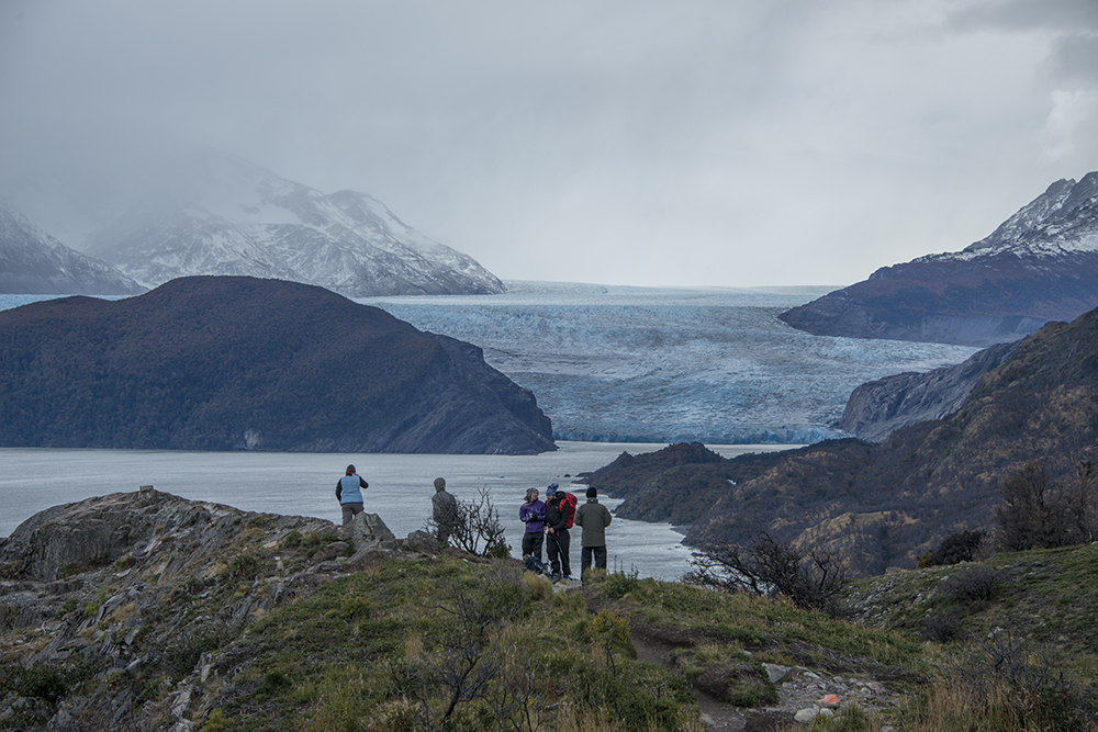
The hike along Lago Grey on day one
As I hiked along Lake Nordenskjold, sustained winds of hurricane force pummeled me. They pushed me so hard that I had to lean into the wind and brace with my walking poles to keep upright. I was blown right to the ground when I stopped to take a picture. The wind whipped up swirling water cyclones several hundred feet high above the lake. Some held life long enough to swirl from the middle of the lake all the way to shore. Spray stung us like flying sand. Despite the southern latitude, the wind was warm and we wore only t-shirts. The previous 3 days along Lago Grey and up the French Valley were much colder and we were bundled up.
The wind while hiking along Lake Nordenskjold was violent
Some tall interesting Lenticular clouds dominated the skies like giant UFO’s. After a few hours, they gave way to solid gray skies and it began to rain.
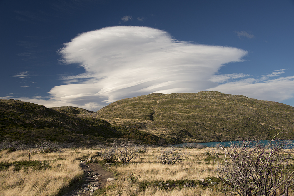
Beautiful Lenticular clouds before the weather turned bad on day four
We took a class on hiking Torres del Paine offered for free in Peurto Natales by a local guide/hostel company. They strongly advised against putting on rain gear if it begins to rain, reasoning that rain showers in TDP rarely ever last more that a few minutes, and temps don’t get very cold during hiking season. Therefore, donning your Gortex while hiking with a heavy pack would simply make you overheat and sweat more than than the brief sprinkle would make you wet. The instructor made fun of people who used rain gear calling them “Gortex Mummies”, and said that he NEVER wears more than a shirt and bandanna during the hiking season. I was very willing to take that advice because I hate hiking in encumbering rain gear, and it’s a hassle to drop your pack to put it on.
The view hiking along Lake Nordenskjold against the feet of Los Cuernos
The light rain continued and indeed my synthetic clothes dried quickly in the warm wind. Going without rain gear in a shower isn’t something I’d normally do in my native Rocky Mountains. Cold weather can move in any time, and if it catches you wet you’re in trouble. After about 4 hours of hiking, the trail left the shores of Lake Nordenskjold and began to ascend up the scenic Acencio Valley.
It was at this point that the weather shifted suddenly for the worse. It began to pour, and the temperature dropped from the 60’s to low 40’s within only minutes. We were caught in T-shirts, and our clothes immediately became soaked. Cold water seeped down my legs and pooled in my boots. We were so intent on finishing our hike that we didn’t stop to change into dry clothes and rain gear. Against common sense, we clung to the advice that this storm would quickly pass, and the labor of hiking uphill would keep us warm.
Sure enough, Karl and I became hypothermic within an hour. My skin was pink with a stinging sensation. My fingers became so numb that they were fixed like lobster claws. My thought and speech became slow. Cold water streamed down my forehead and flooded my eyes, causing my eyeballs to get so cold they couldn’t focus or look around quickly.
The sky was dark and the rain continued. We’d gained enough elevation that we were walking along an open mountainside looking down into the Acencio Valley. The mountain tops were shrouded; the clouds hung so low that we’d be walking straight into them soon.
A small cabin came into view further up the valey. I knew from the map that it was Refugio Chileno, an intermediate stop before our final destination of Camp Torres. It was nestled in a draw with clouds hovering about 100 feet above. Its windows glowed orange with white smoke puffing from the chimney. The mere sight warmed me and added vigor to my zombie-like shuffle. Though it appeared only a mile off, many curves along the mountainside lengthened the approach and made it seem to take forever to get there. Soggy, numb, shivering, incoherent, with about 6 hours of heavy packing pounded into my soles, this was among my most physically miserable experiences.
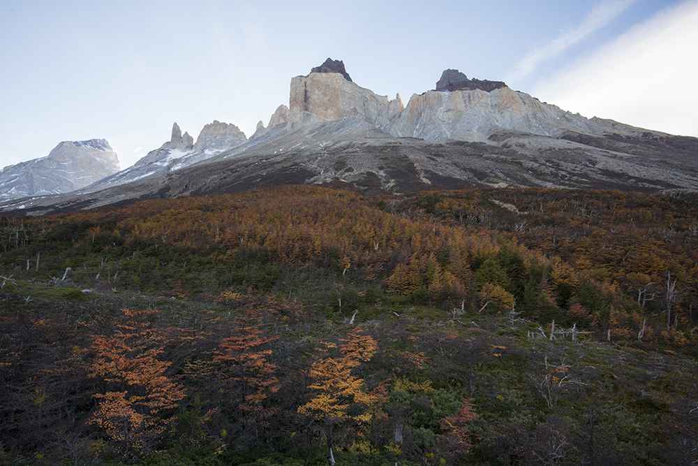
Hiking up the French Valley on day 3
We finally arrived and slogged dripping wet into the empty refugio. Karl and I were the first ones there because we left this morning at first light. The front of the refugio into which we entered was a dining hall. The back was comprised of bunk rooms. The dining hall had vaulted wood ceilings, rustic wood tables, and a hot wood burning stove in the corner. The refugio keeper stood behind a counter where you could order food and drink. Meals were being prepared in the kitchen. These accommodations existed in the backcountry because of an equine supply chain.
I stripped down to my underwear, pulled off my saturated boots and basked before the blazing stove. I could barely untie my laces with my numb fingers. The stove felt like heaven, but I was chilled to the core and couldn’t warm up. I did what any weary hiker would’ve done, ordered a heaping pile of warm empanadas and mug of hot chocolate. Karl ordered a gargantuous hamburger like I’d never seen. It looked like a 2 lb patty, and the bun was literally a round loaf of bread sliced in half. Sitting at a table in warm clothes while devouring piles of South American food was a total paradox from such misery just minutes before. What if this refugio hadn’t been there to save us? We would have changed into dry clothes on the trail and been forced to finish our hike to the top of the valley and set up camp in the rain. An uncomfortable prospect, but not life threatening.
The momentary bliss was dampened by the fact that we still had to go back out and finish the journey. We debated whether it was worth continuing with no sign of the rain lifting. My singular goal was to get the shot of Mirador Torres if at all possible. I was perfectly willing to continue the hike in the pouring rain if there was any chance that the clouds would lift above the mountains by tomorrow morning. However, I couldn’t care less about the pride of being able to say that I hiked all 50 miles of the W circuit or not. If there was no probability of the storm lifting, there was no point in continuing just to say “I did it”.
At the bottom of the French Valley on day 3
As we sat there and deliberated, the other backpackers started pouring in. Some were freezing and soaked, others were “Gortex mummies”, but all looked miserable. In fair weather most people would hike right past this refugio and continue to the top of the valley, but today everybody on the trail came inside. It turned into total chaos. More people crammed into the small cabin than it could comfortably hold. People were getting out of their soggy clothes wherever there was a free spot to stand. Water splashed everywhere and backpacks jammed walkways. The refugio was operated by a private company to sell food and overnight bunks, but wasn’t intended to be an emergency shelter. The refugio keeper became noticeably agitated trying to keep things orderly. Karl and I looked at each other with elation that we’d arrived before the bedlam.
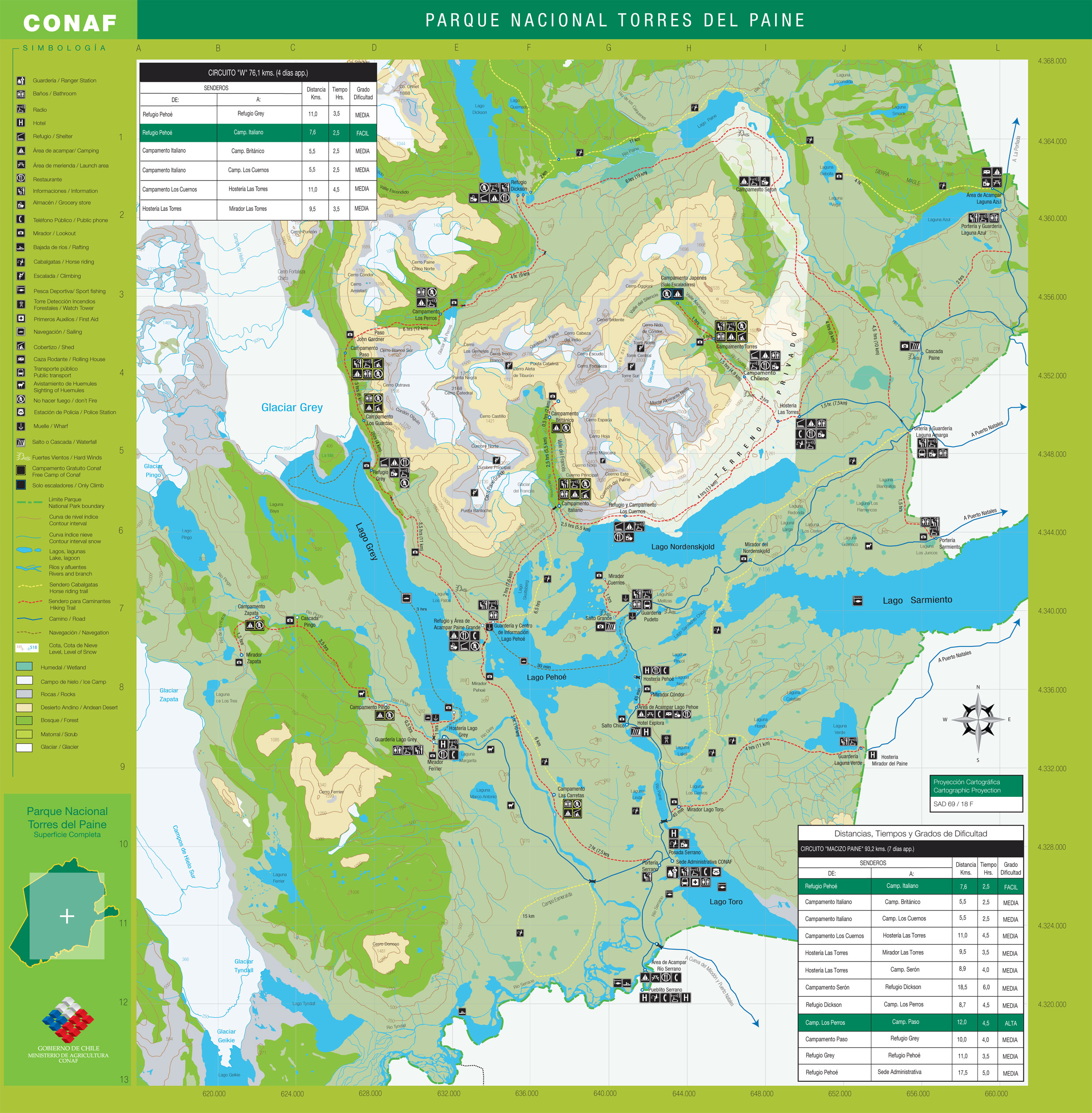
Full size Torres del Paine hiking map
If we were going to continue the journey, now would have to be the time leave because the day grew short. However, we still hadn’t decided if it was worth braving the storm. The indecision in the air was thick because every other backpacker struggled with the same conundrum. Meanwhile outside, so much rain fell that the small streams we’d crossed had turned into raging whitewater and landslides began to collapse from the mountainsides.
The decision was made for us when the refugio keeper got word from Park administration that the park is being evacuated. All hikers were directed to seek shelter or leave the park if close enough to a trailhead. Just then, a guy who hiked a bit further up the valley said that the bridge ahead had been washed out by impassable whitewater. Looks like we were about to have one big slumber party in the refugio. I was disappointed that I came all the way to Torres del Paine and wouldn’t leave with a keeper, but relieved that I didn’t have to go back out into the storm.
There clearly wasn’t enough space in the refugio for everybody to sleep, and the bunk rooms had already been reserved in advance. It looked like a bunch of us would have to hike by dark to the end of the circuit in the rain. I tried to look at the bright side; it was all down hill and I’d be hiking in dry clothes. Luckily it didn’t come to that. There was an adjacent structure used as a spare dining hall that the refugio keeper opened up for people to sleep in. It was an aluminum building (like a large shed) full of picnic benches and a wood stove. Everybody piled in and began to set up; the scene looked like a FEMA shelter during a hurricane. We all had our sleeping mats laid out shoulder to shoulder, crammed into corners and between table legs. As we each tried carve out a little space, gear became spread everywhere and we tried to not get it intermixed with our neighbors’. I ended up loosing a few non-essential items that probably mistakenly ended up in someone else’s pack.
Wind blown Lenga Beech in fall colors
You got to know the other backpackers pretty well because you all follow the same circuit for 5 days. The ferry across Lago Peho delivers one group of backpackers per day to the start of the W circuit. Everybody departs together and follows a prescribed route. You must complete it within 5 days, and make it to the designated camps by the end of each day. If you get tired on one of the long stretches between camps and can’t make it further, you’re out of luck. The only variations to the route are to hike it in less than 5 days, or to hike it in the reverse direction.
People from all around the world were crammed together in the small refugio, and we all had the storm in common to talk about. Out of the 80 or so people, only a handful were American. I used the opportunity to practice my German. The atmosphere inside this rustic wood cabin turned from tense to laid back, with warm wood stoves, hot food and lots of company. Lights-out came at 10:00. I savored crawling into my cozy down sleeping bag, but a sound night’s sleep wouldn’t come with so many people making bodily noises and jostling about.
The next morning I woke to the pelting of heavy rain on the aluminum roof. Karl and I were among the first to depart. The landscape had transformed. The trail vanished in spots beneath landslides. Most of the actual trail was now a stream of water. Small creeks had swelled to 100 ft wide, class-4 rivers that I wouldn’t dare in a kayak. Local news reported that more rain fell in the last 2 days than the area’s entire average annual rainfall.
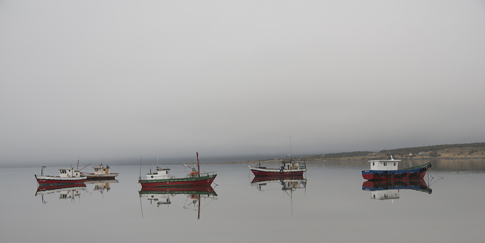
Puerto Natales fishing boats
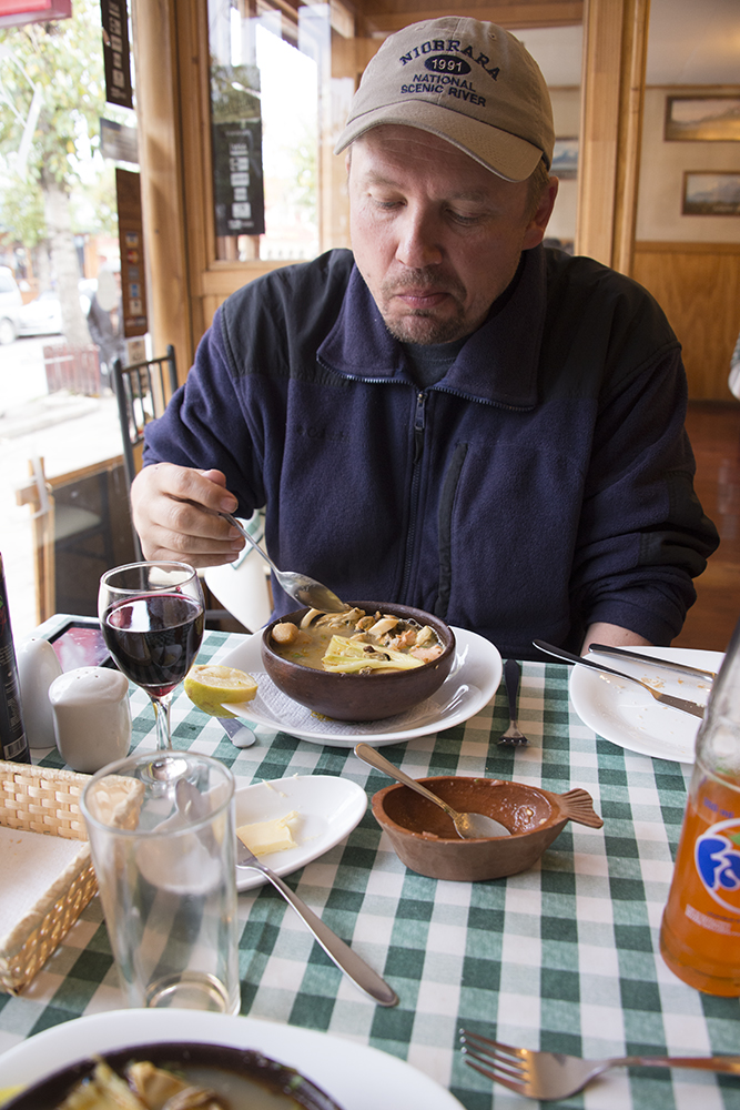
Karl enjoying Magellanic Seafood Soup in Puerto Natales
After a few hours we made it to the end of the circuit unscathed where we’d catch a bus back to Puerto Natales. We were some of the first backpackers to arrive and had to wait around for the buses. There was a lodge that was open where we enjoyed some more hot chocolate while we waited. By the time the buses arrived, so did everybody else who was inside the park. There wasn’t enough space on the buses for everybody. It was total chaos and confusion again. People who’d lost their bus tickets on the trail were desperately trying to get it sorted with the bus drivers. People were sitting on each others’ laps and standing in aisles. Backpacks that didn’t fit in the below-deck storage were crammed in the aisles. To make matters worse, a bridge on the way back to Puerto Natales had washed-out and we had to take a detour that added several hours onto the trip. As I sat crammed between people in damp clothes, with mushy boots, and a bus heater that didn’t work, I daydreamed about the hot Magellanic soup I’d savor at the seafood restaurant back in town.
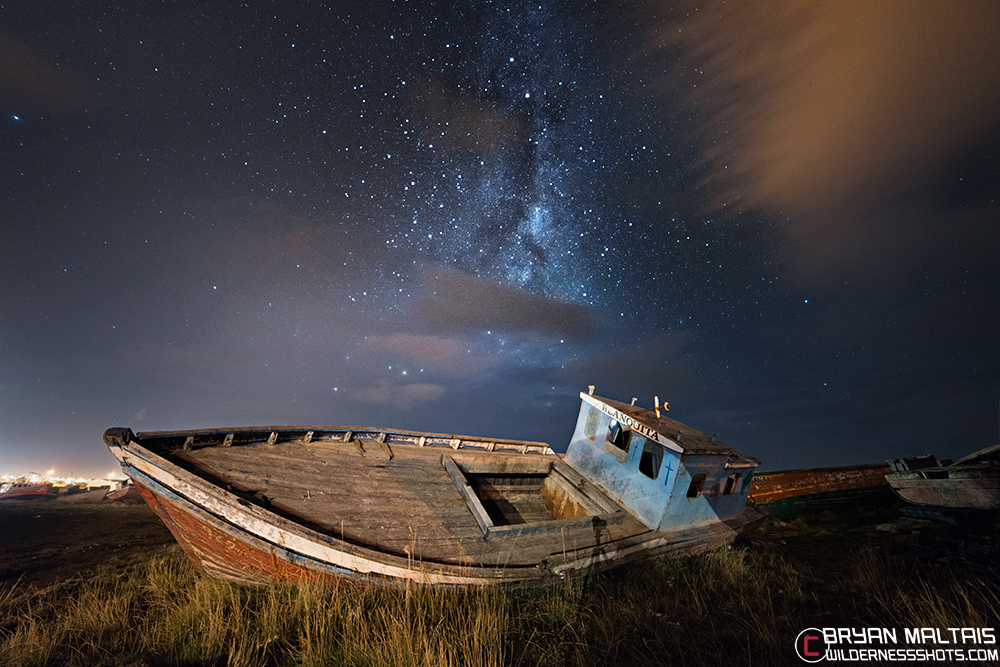
The Milky Way behind a derelict fishing boat in Puerto Natales